The World That Never Sleeps: Remote Sensing of Nighttime Lights
Who'd have thought street lights could be so useful?
"Do not go gentle into that good night, Old age should burn and rave at close of day; Rage, rage against the dying of the light."
Dylan Thomas
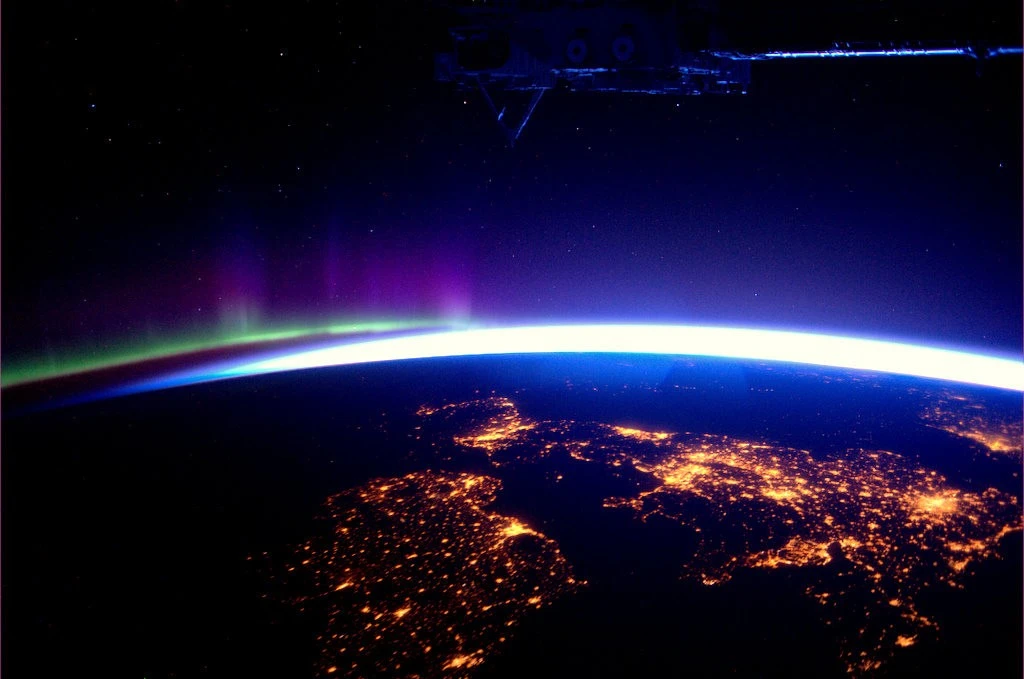
Most shots of Earth at night you’ll have seen will have been taken by astronauts on the International Space Station (ISS), and why not? Their more frequent orbit, comparatively low altitude, and access to top-of-the-line camera equipment often affords them the best views. However, a handful of satellite-borne sensors have and use the ability to collect observations of our planet at night - products often termed nighttime lights (NTL) - and these might be more useful than you’d imagine.
Here, we’ll go through some of the basics of NTL data acquisition and just what we can do with that information.
Who’s watching?
Publicly available NTL imagery began with the United States’ Defense Meteorological Satellite Program (DMSP) in the early 1990s. The continuation of this program is that of the Visible Infrared Imaging Radiometer Suite (VIIRS) - carried on three distinct platforms - and produces the most frequently collected and used data. While free and daily in offering, its coarse native spatial resolution (15 arcseconds, approximately 463 m at the equator) can limit usefulness. That said, derivatives reducing the impacts of the atmosphere, cloud, terrain, vegetation, snow, thermals, and lunar illumination and increasing resolution to around 30 m are available.
While NTL products of some Landsat missions are freely available at reasonably fine resolution (30 m), collection is irregular. For the most precise applications, commercial products like those generated by the Chinese Jilin-01 and Israeli EROS-B satellites offer on-demand sub-metre spatial resolution.
Also important to remember is that spatial resolution is not the only decider in what’s visible in the result but sensitivity to light and observed range of the electromagnetic spectrum (EMS), too.
Not just a pretty picture
Those street lights outside aren’t only good for illuminating our homes and highways. In fact, NTL measurements have been used to great effect in projecting economic size and productivity, estimating population growth and distribution, combatting illegal activity, and responding to disaster.
It’s fairly obvious that the spread and intensity of NTL can be used to infer the size and distribution of populations, but for the same reasons it’s also been found to be a performant predictor of wealth, equality, poverty, and GDP. Testament to the usefulness of NTL in estimating such variables, a satellite dedicated to supporting the closely related UN Sustainable Development Goals (SDGs), SDGSAT-1, can acquire NTL data.
They’re also unsurprisingly effective in monitoring activity in remote areas, a good example being oil exploration and exploitation in north-west Canada. Illicit activities aren’t immune to observation either. Illegal fishing fleets, construction, mining, and agriculture all stick out like a sore thumb against the dark background of our planet’s unlit surface, provided they have the lights on!
 Oil and natural gas exploration and exploitation north-west of Calgary and Edmonton, Alberta.
 A suspected illegal fishing fleet near the Galapagos Islands Marine Reserve, August 2021.
In terms of disaster monitoring and response, knowing where the power’s out is immensely useful in identifying impacted areas, exemplified by 2017’s Hurricane Maria in Puerto Rico and February 2021’s winter storm in Texas.
 Improved resolution NTL data of San Juan, Puerto Rico, pre- and post-Hurricane Maria, September 2017. Source: NASA.
 NTL observations of Houston, Texas, pre- and post-winter storm, February 2021.
Clearly NTL products are niche in comparison to other satellite-derived data. That said, we’ve demonstrated some serious use cases that could not only augment certain analyses but facilitate their becoming 24/7.
Camera shy
Have the street lamps in your area recently changed from a warm orange to harsh, bright white? If so, you’re not alone. The world at large is undergoing a transition from sodium-vapour to LED as lighting technology advances, and this represents a problem for NTL remote sensing. LED lights are more easily directed and dimmed, and emit light in different ways to those that preceded them. For example, blue light isn’t visible to VIIRS’ NTL-data-collecting Day/Night Band, so LEDs emitting more in this range of the EMS are harder to distinguish. And while the improved directionality and dimming should be promising for light pollution, less light finds its way up through the atmosphere to the sensor and the time-based control of lighting that efficient dimming enables may see more settlements “switch off” as night draws on. Not only do these factors make direct comparison between observations featuring modern lighting and those with its forerunners difficult but could make representative future measurements harder full stop.
The jury’s also out on the ecological impact: studies have observed reduced insect populations in proximity to LED streetlights and it’s been theorised their mimicry of daylight disrupts animals from bats to humans. A suggested solution for this is to tune these lights to lower colour temperatures, which may also address some of the above-mentioned threats to NTL data.
What next?
And there you go, a light (no pun intended) introduction into the remote sensing of nighttime lights. If any of the applications mentioned here sound like your thing, or if you thought of one you’d like to explore and exploit, we’re always happy to have a chat. By using NTL data, you’ll do anything but go gently into that good night!
We know using data for business insights or actionable intelligence is complex. At GeoTech, we can help you make sense and better use of both your data and the wide range of data sources available.
Please get in touch with us or reach out on LinkedIn if you'd like to learn more.